Alpine scenery made easy: 4 seasons at the Tateyama Kurobe Alpine Route
Updated as of 26 July 2023
Originally published on 16 October 2020
Coming from an island country with no mountains, the first time I ever came close to a mountain was when I was 21, at the Tateyama Kurobe Alpine Route. The Tateyama Kurobe Alpine Route was the first mountain I ever set foot on, and along with Kamikochi (which I visited on that same trip) it kick-started my love for mountains and nature.
One of the wonderful things about the Tateyama Kurobe Alpine Route is that there is something for everyone: for people of various ages, various levels of fitness, various travelling styles, etc. The route lets the everyday person experience stunning scenery without having to exert much physical effort. But of course, you can enjoy even more spectacular views by hiking from the various stations.

The modes of transport across the Tateyama Kurobe Alpine Route. (Image credit: ©立山黒部アルペンルート)
The Tateyama Kurobe Alpine Route (立山黒部アルペンルート) is an impressive route traversing through the Tateyama mountain range (立山連峰 Tateyama Renpо̄) located on the border of Nagano Prefecture and Toyama Prefecture. To traverse the entire route between Ogizawa (扇沢 О̄gizawa) and Tateyama Station (立山駅 Tateyama-eki), you will need to ride six different modes of transportation. The majestic marvels that you can experience along the route are definitely a must-see at least once in your life. Between 2014 and 2018, I have been back four more times, and I’m sure I will be back again in the future.
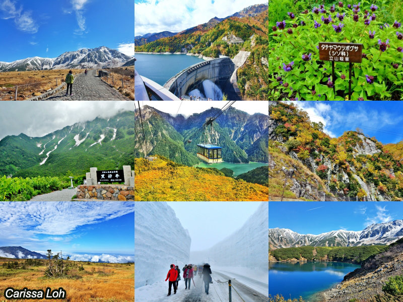
The Tateyama Kurobe Alpine Route in different seasons. (Image credit: JR East / Carissa Loh)
One visit is never enough: there is so much to see and do, and with each season the scenery changes! In this article, I will introduce what you can see and do along the various points of the Tateyama Kurobe Alpine Route, the scenery in different seasons, as well as some of the hikes you can go on. There are many ways to enjoy the Tateyama Kurobe Alpine Route (e.g., one-way full traverse, round-trip between Tateyema Station and Kurobe Dam, round-trip between Ogizawa and Murodo Terminal, etc.), but for this article, we will be introducing the sights in the direction from Nagano to Toyama.
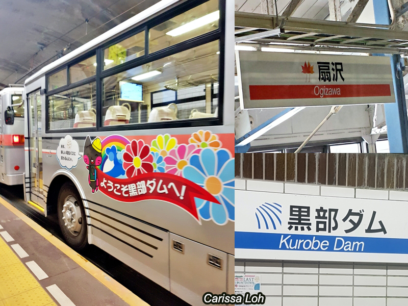
Taking the Kanden Trolley Electric Bus between Ogizawa and Kurobe Dam. (Image credit: JR East / Carissa Loh)
From JR Nagano Station (長野駅) or JR Shinano-О̄machi Station (信濃大町駅) in Nagano Prefecture, take a bus to Ogizawa, the starting point of the Tateyama Kurobe Alpine Route on the Nagano side. After reaching Ogizawa, take a 16-minute ride on the Kanden Trolley Electric Bus to the Kurobe Dam. This vehicle passes through a tunnel, and it is along this ride that you will cross the border between Nagano Prefecture and Toyama Prefecture.
After alighting the bus, climb the steps up in anticipation and you will emerge on the walkway of the magnificent Kurobe Dam, where you will take a 15-minute walk across to board the cable car up to Kurobedaira.
Kurobe Dam
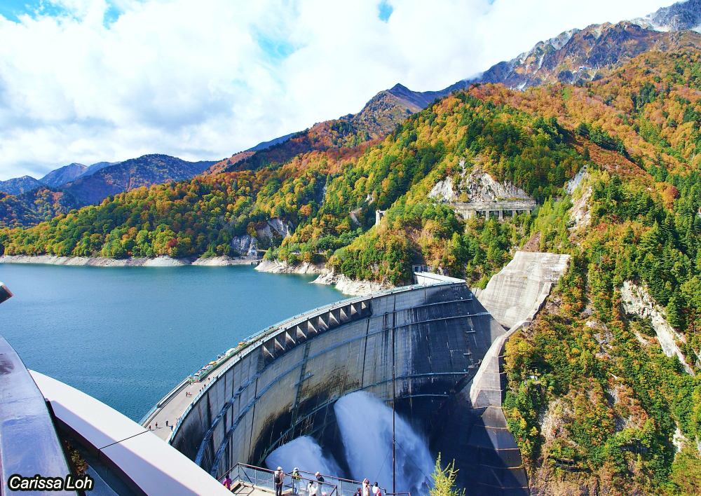
View of the Kurobe Dam from the Dam Observation Deck. (Image credit: JR East / Carissa Loh)
Standing at 186m in height, the Kurobe Dam (黒部ダム Kurobe-damu) is Japan’s tallest dam. On one side is the serene Lake Kurobe (黒部湖 Kurobe-ko), while on the other side, you can see powerful discharges of 10 cubic metres per second. Water is discharged from the dam only from late June to mid-October, and on good days you can even see a rainbow!
Constructing the Kurobe Dam was a major project for Japan after World War II, with the sudden economic facing a shortage of energy. Due to the difficulty of constructing the dam, 171 workers lost their lives. Along the dam there is a monument dedicated to them. There was even a novel—Kurobe no Taiyō (黒部の太陽)—written about the dam’s construction, which was later made into a movie.
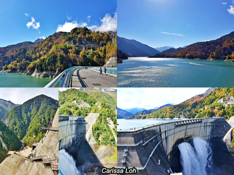
Lake Kurobe and the Kurobe Dam. (Image credit: JR East / Carissa Loh)
If you want to enjoy the scenery from a different angle, 30-minute sightseeing boat cruises across Lake Kurobe are also available between June and early November. At 1,448m, these are the highest-sailing sightseeing boats in Japan.
Tip: To get a bird’s eye view of the dam, head over to the Dam Observation Deck, which is a 220-step climb up. Due to time limits, most group tours skip this spot, so it is usually not so crowded, and the views are spectacular. Autumn in this area is usually around mid to late October.

The Kurobe Cable Car. (Image credit: ©立山黒部アルペンルート)
After crossing the dam and taking a 5-minute ride on the Kurobe Cable Car (a funicular) up, you will arrive at Kurobedaira. The Kurobe Cable Car is located entirely underground, so it can operate even during snowfall—something to take note of if you want to visit in November to see snowy sights.
Kurobedaira

Kurobedaira in autumn. (Image credit: JR East / Carissa Loh)
At Kurobedaira (黒部平) is a pleasant garden which you can easily stroll around, making it perfect for families with elderly and small children. During autumn (late September to mid-October), you can see the changing colours in the valley below, and on the mountains behind.
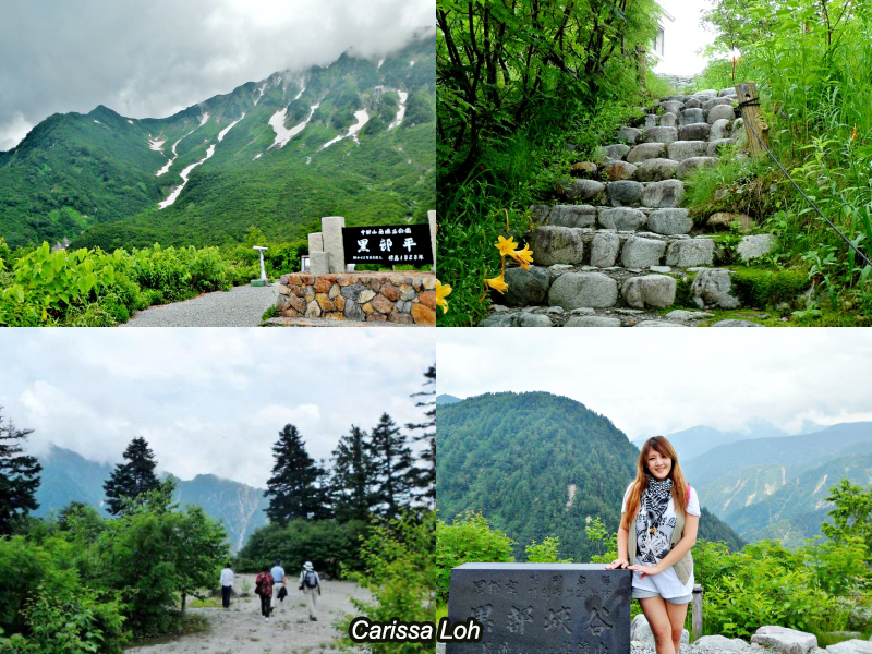
Kurobedaira in summer. (Image credit: JR East / Carissa Loh)
Kurobedaira is located 1,828m above sea level, so you can see a variety of high-altitude plants here. During summer (July to August), the mountains and valleys are enveloped in verdant greenery, although you might still be able to see snowcapped peaks and frozen streams on the higher mountains.
Tateyama Ropeway
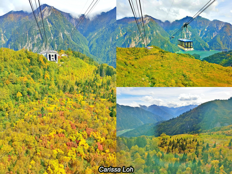
Autumn foliage as seen while riding on the ropeway. (Image credit: JR East / Carissa Loh)
From Kurobedaira, you will next take a 7-minute ride on the Tateyama Ropeway to Daikanbo (大観峰Daikanbо̄). The panoramic ropeway ride provides dynamic views of the emerald waters of Lake Kurobe and the surrounding mountains as you rise up.
Tip: Position yourself by the windows for the best views on the ropeway ride. This area experiences an explosion of autumn colours around early to mid-October, turning into a frenzy of bright yellows and oranges, a stunning panorama of colour. The 360º view of the surrounding scenery as you change 500m in elevation is a spectacular experience.
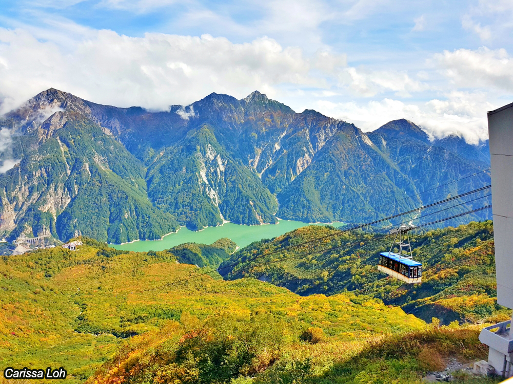
View from Daikanbo. (Image credit: JR East / Carissa Loh)
If you were unable to snag a good spot on the ropeway, fret not. At Daikanbo you can head up to the observation deck on top of the ropeway station for a wide view of Mount Akasawadake and Lake Kurobe below.
Marvellous scenery at Murodo Terminal—the highest stop

The “must-take” photo spot at Murodo Terminal. (Image credit: JR East / Carissa Loh)
At Daikanbo, transfer to the Tateyama Trolley Bus, a bus powered by electricity, which passes through a tunnel carved under the Tateyema Mountain Range. After a 10-minute ride, you will end up at Murodo Terminal (室堂ターミナル Murodо̄ Tāminaru), the highest point which the vehicles can take you to.
The Murodo area is located 2,450m above sea level, and is the highest point you can reach by transport on this route. Anything higher, you will need to go by foot. Right after stepping out of the terminal, you can already see amazing alpine views.

Setting off on a hike from Murodo. (Image credit: JR East / Carissa Loh)
Around the terminal are hiking courses of various levels of difficulty, ranging from short trails suitable for tourist groups, to longer trails for climbing enthusiasts. Stone-paved paths mark the start of the hiking courses, with most of the stones being sourced from the mountain. The Tateyama Kurobe Alpine Route tries to be as environmentally friendly and energy-conserving as possible, trying to reduce the amount of extra items being brought into the mountains. All forms of transportation run on either electricity or hybrid gas, and cars are not allowed past the starting points (Tateyama Station and Ogizawa).
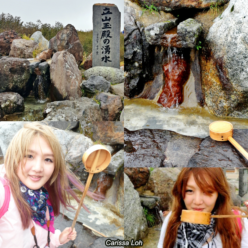
Drinking delicious spring water at Murodo. (Image credit: JR East / Carissa Loh)
Before setting off for a hike around Murodo Terminal, quench your thirst with fresh spring water. The Tateyama Tamadono Spring Water (立山玉殿の湧水 Tateyama Tamadono no Yūsui) comes from melted snow from the Tateyama Mountains, and is really cold, invigorating, and delicious! The water can be drunk from June onwards, when the snow starts to melt. Due to its source being melting snow, the temperature of the water remains a cool 2–5ºC all year round, even in summer.
Hiking to Mikurigaike Pond and beyond

Alpine flora in summer. (Image credit: JR East / Carissa Loh)
Summer is a fantastic time to see the mountains covered in lush greenery and a variety of alpine flowers, and is often considered the best season to visit for nature lovers looking to go on hikes or climbs to higher elevations. At Murodo, the temperatures are up to 15ºC lower than the cities below, so even during summer the highest temperature is around 18ºC.
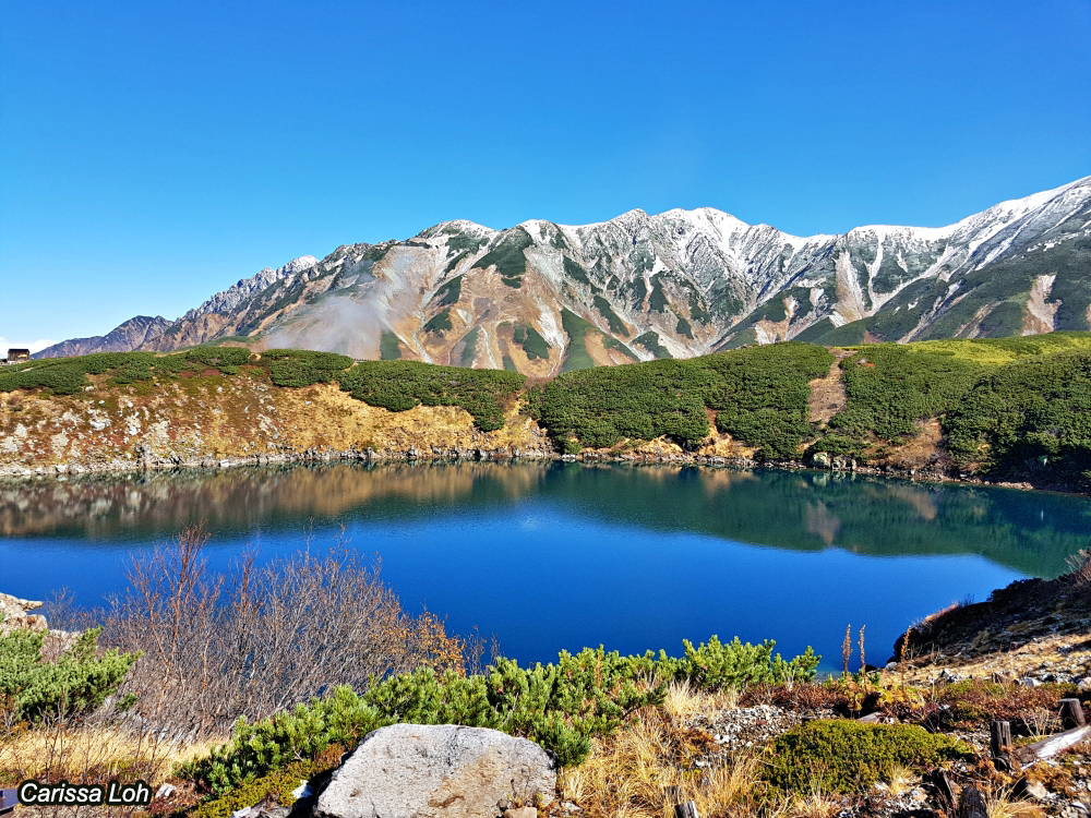
Mikurigaike Pond. (Image credit: JR East / Carissa Loh)
A short 20-minute walk from the Murodo Terminal is the beautiful Mikurigaike Pond (みくりが池). With cobalt blue waters reflecting the sky, this caldera lake is one of the most picturesque spots at Murodo. Mikurigaike Pond is sometimes referred to as the “God’s kitchen”, as it is said that the water is used to cook the meals for the gods residing in the mountains.

Mikurigaike Pond in different seasons. (Image credit: JR East / Carissa Loh)
As Mikurigaike Pond is located over 2,400m above sea level, even during late July (top right photo), the edges of the pond are covered in snow and ice. During October (left photo), the top of the mountain peaks will be blanketed in white due to the first snowfall, and it is a stunning sight to see the mountains and the sky reflected in the pond on clear days.
Raichozawa Hiking Course

A colourful autumn at Raichozawa. (Image credit: ©立山黒部アルペンルート)
Continue on for about an hour from Mikurigaike Pond and you will reach Raichozawa (雷鳥沢 Raichо̄zawa). This is a popular spot for setting up tents in summer and autumn, and the view of the soaring mountains surrounding you from all sides is spectacular. There is also a few mountain huts here where you can stay overnight, which all have onsen (温泉 hot springs), some of the highest in Japan! A round-trip loop from Murodo Terminal to Raichozawa takes about 2.5 hours.
Mount Oyama Hiking Course
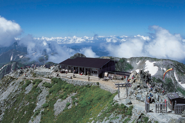
Summit of Mount Oyama. (Image credit: (公社)とやま観光推進機構)
From Murodo Terminal, hiking enthusiasts can climb for around 2 hours to reach the 3,003m summit of Mount Oyama (雄山), one of the peaks of the Tateyama Mountain Range. At the summit, there is a small shrine, and on clear days you might even be able to see Mount Fuji. The descent back to Murodo will take about 1 hour 40 minutes.
Wildlife at Murodo
Adult and baby raicho. (Image credit: ©立山黒部アルペンルート)
Wildlife enthusiasts might be excited to know that ptarmigans (or snow grouses) can be spotted at the Tateyama Mountains, although they are often hiding. Known as raichо̄ (雷鳥) in Japanese, the literal translation of the name is “thunder bird”. These birds got the name because in order not to be eaten, they come out only during bad weather (thunderstorms). It is said these birds bring happiness to those lucky enough to see them.
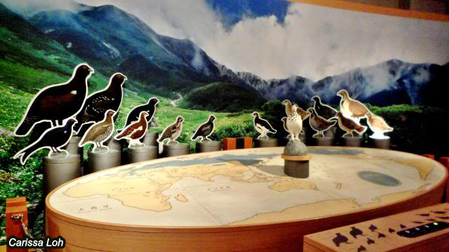
Learn more about raicho at the Tateyama Nature Conservatory Center. (Image credit: JR East / Carissa Loh)
Welcome to Ptarmigan Country! The Tateyama Nature Conservatory Center (立山自然保護センター Tateyama Shizen Hogo Sentā) is a museum dedicated to nature, located at the Murodo Terminal. At the museum, you can learn more about different types of raicho around the world, other creatures that dwell in the Tateyama Mountains, as well as the history of Mount Tateyama. Check out the English pamphlet here for more information.
Stay overnight

Stay overnight at Murodo for a surreal experience. (Image credit: Hotel Tateyema)
Despite Murodo’s high altitude, there is a hotel, a couple of onsen (温泉hot springs), mountain huts (山小屋 yamagoya), and camping grounds to cater to hikers. For those looking to enjoy the area a bit more, I recommend spending a night at Murodo. Before going to bed, take a short walk outside—the star-filled night skies will surely fill you with wonder and awe. In the morning, you can experience goraikо̄ (ご来光 sunrise from the mountain).
Snowy wonderland in spring and winter

Snow walls in mid-April. (Image credit: JR East / Carissa Loh)
The Tateyama Mountain Range experiences some of the highest snowfall in Japan, hence the official open season is only from around mid-April to mid-November each year. It usually starts snowing at Murodo from late October, so due to increasing snowfall the entire route is closed from mid-November to mid-April.
However, due to the high altitude, even in April–June you can experience winter-like conditions at Murodo, and this is when you can see one of Tateyama Kurobe Alpine Route’s most famous sights: the towering snow walls (雪の大谷 Yuki no О̄tani). Before the opening of the season, machines plough through the accumulated snow to make a path for buses to drive along, leaving massive snow walls lining the sides of the road. The highest parts of the snow wall can reach a soaring 20m, and is truly an amazing sight to behold. When I visited, it was mid-April, but at Murodo the temperatures were around -7ºC, and it was snowing!

Snow walls on a clear day. (Image credit: (公社)とやま観光推進機構)
Tip: Mid-May to June is the period where there is the highest chance of good weather for viewing the snow walls. Although the highest walls are usually seen in April, the weather is still unstable during April, so whiteouts and snowfall are still common.
In May, there are many more sunny days compared to April, and the snow walls are still high. However, it is also the most crowded time, especially during the Golden Week holidays in early May. In June, as the weather heats up, the snow melts, and the walls do not appear as high compared to May, but can still reach considerable heights of 10m. There are fewer visitors in June, so come during this time if you want to avoid the crowds.
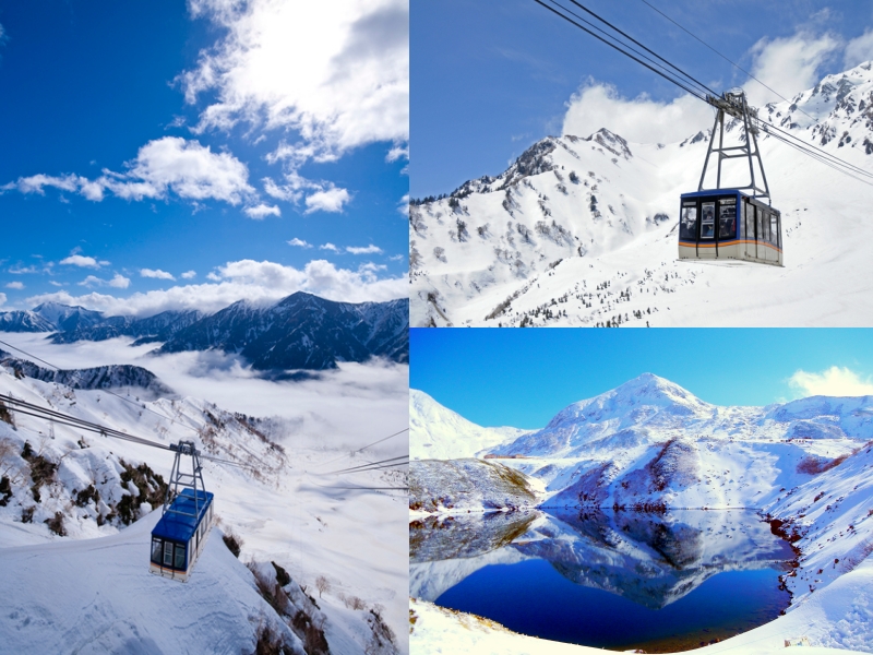
Beautiful snowy scenery. (Image credit: (公社)とやま観光推進機構)
In times of bad weather or large amounts of snowfall, the buses between Bijodaira and Murodo Terminal on the Toyama side of the route may be suspended or experience delays in operation. However, on the Nagano side the transport is ropeways / vehicles in tunnels which can still operate during inclement weather, so if you want a higher chance of reaching Murodo when there is snowfall, the Nagano side is your safest bet.
Hiking around Midagahara, an alpine wetland

Midagahara offers easy and scenic hikes. (Image credit: JR East / Carissa Loh)
From Murodo to Bijodaira, the mode of transport is a highland bus. Most tourists will take the direct bus ride, but if you are a fan of nature, I highly recommend stopping at Midagahara (弥陀ヶ原) for a short hike.
Located at 1,930m above sea level, Midagahara is a beautiful alpine wetland with easy-to-walk wooden boardwalk trails. Due to its high elevation, Midagahara’s temperatures are around 10°C lower than ground level, making it a cool place to hike in summer and autumn.

Sea of clouds at Midagahara. (Image credit: JR East / Carissa Loh)
In autumn, the grass turns yellow-orange, and on clear days you will be able to see a sea of clouds (雲海 unkai). One of the reasons I enjoy climbing high mountains is the feeling of being above the clouds. At Midagahara, you don’t even need to climb to see the unkai, it’s just a flat walk away!

Toyama elementary school children on a field trip to Tateyama Kurobe Alpine Route. (Image credit: JR East / Carissa Loh)
One thing I really admire about Japan is how it tries to instil love and respect for Nature in children from a young age. I have been told that many Nagano Prefecture junior high schools bring their students to climb Mount Tsubakuro, and I heard from a Tateyama Kurobe Alpine Route staff that almost all elementary school students in Toyama will visit the Tateyama Kurobe Alpine Route with their school to go hiking. During my first visit in July 2011, I saw quite a few groups of children with their striking yellow caps around Midagahara.
Cedar forests and waterfalls

Giant cedar trees and Shomyo Falls as seen from the bus. (Image credit: JR East / Carissa Loh)
After a hike around Midagahara, continue on a bus towards Bijodaira. During the 30-minute bus ride you will pass by sights like thick giant cedars, as well as the 350m Shomyo Falls (称名滝 Shōmyō-daki), the highest waterfall in Japan. Much of its water comes from the snow melt from the Tateyama Mountains, so the flow is greatest in summer.

Shomyo Falls with a rainbow (left) and with Hannoki Falls (right). (Image credit: (公社)とやま観光推進機構 (left) and JNTO (right))
Only during April–July, the adjacent Hannoki Falls (ハンノキ滝) appears. At 500m, it is Japan's tallest seasonal waterfall. You get just a glimpse of the waterfalls from the bus, so if you’d like to get closer, take a 15-minute bus from Tateyama Station to Shomyo Falls Bus Stop, then walk 30 minutes to the waterfall viewing deck.

Bijosugi. (Image credit: ©立山黒部アルペンルート)
Bijodaira (美女平) means “beautiful lady plains”, and is known as a treasure trove of virgin forests containing beech trees and Tateyama cedars. In particular, the area is famous for its bijosugi (美女杉 beautiful lady cedar) tree, that is said to bless couples with happiness. Many of the other cedar trees in this area are ancient and large, growing up to 30m high and some estimated to be over 1,000 years old.
Around the station, there are 2–4km (1–2.5 hour) walking courses where you take a pleasant stroll and get up close to the ancient cedars. If you’re lucky, you might even encounter some of the unique wildlife that inhabit the area, such as the Japanese antelope.

The Tateyema Cable Car. (Image credit: JR East / Carissa Loh)
From Bijodaira, it is a 7-minute ride on the Tateyama Cable Car (another funicular) to Tateyama Station. At Tateyama Station, you can take a 15-minute bus ride to Shomyo Falls, or take a 1-hour ride on the Toyama Chiho Railway to Toyama City.

Takaoka City and Toyama City against a backdrop of the Tateyama Mountain Range. (Image credit: (公社)とやま観光推進機構)
Within Toyama Prefecture, the majestic Tateyama Mountain Range creates a stunning backdrop for many of its cities, such as Takaoka City or Toyama City. After traversing the Tateyema Kurobe Alpine Route, rest and relax at these cities and enjoy the delicious seafood from Toyama Bay.
The Tateyama Kurobe Alpine Route is filled with so much beautiful scenery, and is suitable for many types of visitors—both hiking enthusiasts and those with an aversion to walking; both young and old; couples, families, friends, solo travellers—letting them get up close to high-altitude vistas that are usually hard to access. The Tateyama Kurobe Alpine is truly a feat of engineering, and I hope that you will visit it someday!
Getting there

The Tateyama Kurobe Alpine Route. (Click to enlarge) (Image credit: ©立山黒部アルペンルート)
The Tateyama Kurobe Alpine Route runs between Ogizawa in Nagano Prefecture and Tateyama Station in Toyama Prefecture. It can be reached from Toyama Station (富山駅) in Toyama Prefecture, or Shinano-О̄machi Station (信濃大町駅) or Nagano Station (長野駅) in Nagano Prefecture.
From Nagano Prefecture:
- From JR Nagano Station, take a 1 hour 45-minute bus ride to Ogizawa (扇沢), the start of the Tateyama Kurobe Alpine Route on the Nagano side. Alternatively, you can also take a 40-minute ride on a local bus from JR Shinano-Omachi Station to Ogizawa (扇沢).
From Toyama Prefecture:
- From Dentetsu-Toyama Station (right beside JR Toyama Station), take a 1-hour ride on the Toyama Chiho Railway to Tateyama Station (立山駅), the start of the Tateyama Kurobe Alpine Route on the Toyama side.
Coming from Tokyo:
- Take the Hokuriku Shinkansen from JR Tokyo Station to JR Nagano Station (about 1.5 hours) or JR Toyama Station (about 2 hours), then transfer as above depending on which side of the route you would like to start on.

The Hokuriku Arch Pass is a convenient way to get around the Hokuriku region. (Image credit: JR East)
If you’re coming from Tokyo or Osaka, use the Tateyama Kurobe Option Ticket in conjunction with the 7-day Hokuriku Arch Pass to maximise savings! Check out my other article for a 7-day itinerary across the beautiful Hokuriku region with the Hokuriku Arch Pass.
Header image credit: (公社)とやま観光推進機構


